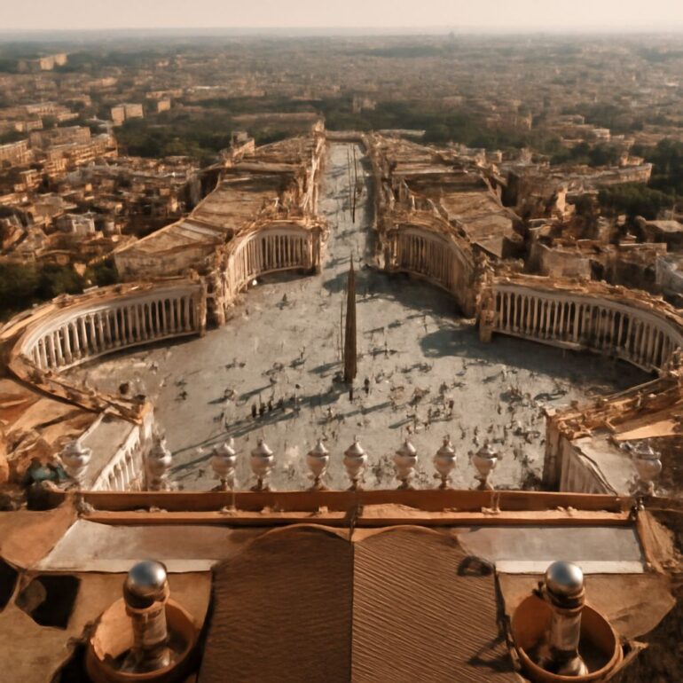
The walls around the Vatican are the product of several centuries, from the medieval defenses of Pope Leo IV to later fortifications and changes made in a much altered city. They help define the appearance of Vatican City, but a visitor cannot identify its entire modern border simply by following old masonry.
Vatican City’s walls and its legal boundary belong to different histories. The state was established by the Lateran Treaty in 1929; St. Peter’s Square forms part of its territory even though the square opens toward Rome. The Vatican’s geography page describes a state partly surrounded by walls and identifies a ground marker at the square.
Vatican City Wall: A Boundary With Layers
The wall around the Vatican is often discussed as though it were one continuous structure built at one time. In fact, the visible enclosure includes work from different periods. The older Leonine defenses protected an area associated with St. Peter’s basilica, while subsequent popes reinforced or altered fortifications as the buildings and needs of the area changed.
A modern map answers a different question from a historical plan. It shows the territory of Vatican City State, an enclave within Rome, rather than the complete extent of every earlier defensive line. The Holy See’s map and legend identify part of the border of the Leonine City as well as the Passetto, entrances, gardens, and other landmarks. Comparing those labels with the present territory is a practical way to see the layers.
The term Vatican City wall can describe masonry near the present state, but it does not assign a single date to every section. A wall may have been rebuilt, raised, incorporated into another structure, or left inside a later perimeter. Determining the history of a particular stretch requires a source about that stretch, not just an estimate based on its appearance.
Leo IV and the Medieval Enclosure
In the middle of the ninth century, Pope Leo IV ordered defenses for the Vatican area. Rome’s municipal tourism service links the Leonine Walls to the protection of the area against Saracen raids. St. Peter’s then stood outside Rome’s older principal defenses, and the enclosure protected the basilica and neighboring buildings.
The walls gave their name to the Leonine City. Rome’s account of the Passetto di Borgo dates the wall to around 852 and describes a wall about 16 feet high with a walkway. That measurement is a description of the historical structure, not a uniform height for every wall visible today. The surrounding city, the basilica, and the defenses have all changed since the ninth century.
The enclosure was a response to a specific medieval setting. Its towers, routes, and gates served an area of churches, residences, and approaches to St. Peter’s. It would be misleading to explain its construction as a decision about the boundaries of a state that would not exist until 1929. The history of the stones and the history of sovereignty meet here, but they start at different dates.
Later Fortifications and the Passetto
The Vatican walls were reinforced through later projects. Rome’s historical overview names work under Paul III, Pius IV, Pius V, and Urban VIII, spanning the 16th and 17th centuries. These projects strengthened defenses around St. Peter’s and Vatican Hill. Their long sequence helps explain why the perimeter seen in photographs cannot be treated as a single ninth-century construction.
A bastion is a projecting part of a fortification, designed as part of a defensive system. Such features can change the outline of a wall as well as its appearance. Later additions also reflect the gradual development of the Vatican’s buildings and gardens. The Vatican Museums’ history of the gardens notes that cultivated land extended beyond the Leonine Walls in an earlier period, a reminder that a medieval line and a later enclosed landscape need not coincide.
The Passetto di Borgo is an elevated fortified passage linking the Vatican area with Castel Sant’Angelo. Rome’s account identifies additions and renovations by several popes and records its use as an escape route by Clement VII during the 1527 Sack of Rome. Its route continues toward the castle in Rome; it should not be mistaken for the modern international border merely because it is connected with historic papal defenses.
The Treaty and the Modern State
The Lateran Treaty was signed by the Holy See and the Kingdom of Italy on February 11, 1929, and ratified that June. It established the territorial basis of Vatican City State. The Holy See is the central authority of the Catholic Church; Vatican City is the territorial state associated with it. The distinction matters because the Holy See also uses properties in Rome that lie outside the state’s territory.
Article 3 of the treaty refers to a plan defining the city’s boundaries and states that St. Peter’s Square is part of Vatican City. Article 5 addresses closing access and enclosing open sections, with an exception for the square. The legal line therefore follows the treaty and its plan; a photograph of masonry alone cannot establish where the border runs.
At St. Peter’s Square, Bernini’s colonnade frames an open approach to the basilica. A colonnade is a row of columns; here its curved arms organize a public space rather than presenting the continuous face of a fortress. The Vatican’s geography page describes a marble strip joining the outer parts of the colonnade as the boundary at the square. It also explains the role of Italian police there under the applicable arrangements.
Entrances and the View From Outside
The wall around Vatican City is punctuated by entrances that serve different purposes. The Vatican’s map labels the Saint Anne entrance and the Vatican Museums entrance among other points. The state geography page directs museum visitors to Viale Vaticano, near Piazza del Risorgimento. A person planning a visit should consult the destination’s current instructions, because an entrance on a map is not necessarily a public visitor entrance.
Another example of change is Porta di Santa Rosa. The Vatican Museums describe the gateway facing Piazza del Risorgimento and its use for access to the Via Triumphalis archaeological area. The gateway is a modern feature within a setting marked by older walls; it illustrates how access can change without making all the surrounding masonry contemporary.
Seen from the streets, long stretches of the Vatican City walls, towers, and gates create an image of a contained city. The open square changes that impression: it provides a broad visual connection between Rome and the basilica. UNESCO describes the site in terms of both its enclosure and its opening through the colonnade in its World Heritage entry.
How to Tell Wall From Border
For a historical wall, ask who built or altered the particular section, when, and for what documented purpose. For the modern border, use the treaty’s territorial plan and the Vatican’s current map and description. A section of the Vatican wall may coincide with a boundary, while the Passetto and the open edge of St. Peter’s Square show why the two lines should not be assumed identical everywhere.
